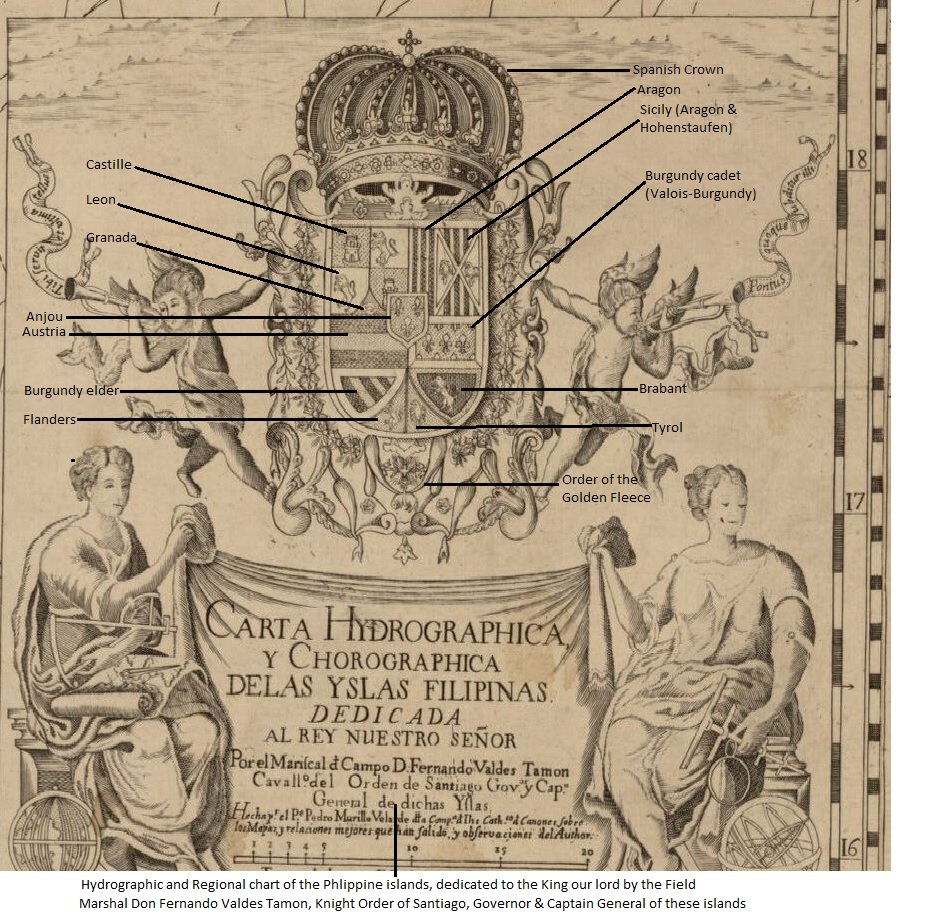
The arms of King Felipe V of Spain feature prominently on the 1734 Carta Hydrographica y Chorographica de las Islas Filipinas. The map, more commonly known as the Murillo Velarde map, was completed by Spanish cartographer Pedro Murillo Velarde and two Filipinos: engraver Nicolás de la Cruz Bagay and artist Francisco Suarez. It is recognized as the “first and most important scientific map of the Philippines“.
The myriad lineages of the King can be deciphered from the coat of arms, annotated here by Jude Antonio K. Grupe: